

The Global Paddling Community
Independent - Daily
Login / Connect
Forums
SUPzero Forums
Market
- Small Pyranha Loki for sale » Hi Charles, Unfortunately this post is over 4 years old so I would imagine the boat has been sold... (FS - North America - US)
- Necky Blunt for sale » Is your boat still For sale... (FS - Africa)
- WTB Jackson Funrunner 60 » Looking for a Funrunner 60... (FS - North America - US)
 |  |
[please login to make this ad block disappear]
Northern Tasmania, Launceston, The Cataract Gorge
 | Play Run, Australia, Northern Tasmania, Launceston, South Esk River, The Cataract Gorge |
What's it like

The full length of the Cataract Gorge run begins at the bottom of the Trevallyn Dam, operated by the Hydro. Although some people would ague that it starts above (not legal), a couple of my local kayaking friends got in quite a bit of trouble for doing this, plus a couple of broken boats to match. Mind you they did have an article published about it in FHM or Raplh magazine.
The trip is about 5 kilometers and if every stopper etc is checked it will take 1/2 of the day, the first time you shoot it. Although I know people who have a tendancy to rush these things and travel it in about 45 minutes, it would be a pitty...
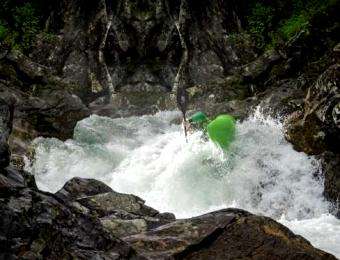
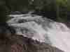
The Gorge can range from grades 3/4 to grade 5/6 so I think local knowledge comes in handy (and trust me, I have learnt my lesson). The Cataract Gorge as the name suggests is surrounded on both sides by cliffs and hilly country. This is not a river you would paddle by yourself. I personally have only ever paddled sections of this run but it really is a great river. The only big problem that can occur, especially in flood, is if the tide begins to get low the last couple of stoppers can quickly change from grade 4, easily punch through stoppers, to grade 5 ones which launch your boat up into the air and start munching you up. I've been behind my brother when this happened and I saw his boat get launched about 2 ft out of the water, and then it was my turn as the stopper covered the whole river. My brother lost 2 paddles that week; some very mad water...
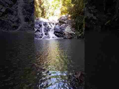
The Gorge is not only world famous for its great water, but also for the nature beauty (drawing in heaps of tourists) and is a great swimming spot in summer.


How to get there
Launceston is home to this amazing river, and the Gorge is only 10 minutes from the center of town. The Cataract Gorge is part of the South Esk catchment system and finishes where it joins the Tamar River. There are a number of shorter runs which can be paddled; you don't need to do the whole lot. I tend to just do the more exciting bits. You can do the Kings Bridge section which consists of 5 or 6 largish rapids (this is about 1 km). Or you can get in a bit higher and come down from under the swinging bridge area which is good fun in high flood (making it about 2 kms). But there are still a lot of good rapids near the top of the run.


More info
The Distance from Trevallyn Dam to Kings Bridge is approximately 5 Km.
The Average gradient is 20m/km and the Peak gradient: 60m/km (near the old Duck
Reach power station).
Difficulty ranges from between Grade 3-4-5-6. (depends on water hieght) (The
best time of year to paddle this river is winter as the Hydro controls the level
of water they let out, unless the dam is spilling).
The trip usally takes about 3 hours.
Entry / Exit Points. You should enter the river via a track from the Trevallyn
Dam Car Park, located at Grid ref. (F.Q 071 112). The best exit point is at the
Lady Stelfox jetty on the RHS after Kings Bridge, located at Grid ref. (EQ 105
126). You can also get out at the Tamar Rowing Club jetty on the LHS. If you
are shoot the rapids just above Kings Bridge, there is a hidden set of old stairs,
50 - 100 M from the last rapid on the LHS, leading to the footpath.
Map Ref.(Tasmap: 1:100 000 St. Patricks)
It is essential to inspect all main rapids. Rapids of note include a long grade
4-5 section from the first concrete weir - check the stopper at the bottom of
Rooster tail rapid. At the start of the long straight into Duck Reach, look out
for a rock ledge hidden by a stopper in mid current. Just below the old Duck
Reach power station is a huge boulder rapid. Portage on the right or take the
chicken shute on the right. Just below Duck Reach there is a large island. The
right hand channel consists of 3 main drops. The RHS of the island has been paddled
up to about 3000 cusecs and would become extremely big at higher flows. The LHS
channel is a very steep continuous rock garden and will requires precise manoeuvering.
The rapid visible upstream of the suspension bridge. Watch for some powerful
stoppers, especially on the concrete weir near the bottom. From the Basin to
Tamar river. There canbe a bad stopper on the RHS which should be avoided and
remember the very last fall will vary according to the tide.
If problems occurs it is possible to walkout in a number of locations, there is an access track which runs up the river's right bank from the Second Basin, and there is an access track at Duck Reach (With car park). There is also another car park at the Basin. And a walking track on river LHS, running all the way along the last section in the Gorge.
This river has been paddled up to about 35 000 cusecs (i think the photos above are about 30 000 or 35 000 cusecs).
I've paddled it between 5000 and 6000 cusecs
Bureau of Meteorology, Australia
Recorded Rainfall
River Height
It can be helpful if you know how much water is spilling over the dam.
Locals
Nice people in L'ton, but if you paddle the Gorge you will recive lots attention from the tourist, trying to get a photo.
Events
In 1992 the World Cup Slalom was held in the lower section of the Gorge (the best bit in my opinion) above Kings bridge.
Each year the local Duck race is held where thousands of rubber ducks are let loss to fight the rapids.
There are also guided tours held by experienced rafters, this seems to be more a tourist thing as i have never seen it advertised.
The Cataract Gorge is also home to one of the longest single span chair lifts in the southern hemisphere.
The Gorge is really a muti fuctionial centre for Launceston, and is especially for us paddlers, i live 5 Mins away.

Facing Kings Bridge.
Info sources
Dave - Tassiepaddle


 Get for free:
Login to post here


 |